

Ground-level Agricultural Survey System (GLASS)
Using Street-level Imagery for Automated High-resolution Assessments of Farming Practices

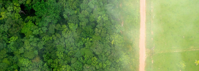
Deforestation, Kate Evans CIFOR, February 2013, Modified
Smallholder farmers produce over 80% of the world’s food but are often poor and food-insecure themselves (FAO, 2014). Food insecurity is linked to a host of diet-related health outcomes, including the so-called “double burden” of deficient and excessive caloric intake.
Pretty, et al., found that food production improvements in the Global South came not from increasing cereal productivity, but from farm intensification or incorporating home gardens, rice paddies, and crop mixing. These frequent practices do not always register on land use surveys and may have nutritional or economic impact of unknown significance. This project will use Google Street View imagery to inventory which innovative, intense practices are being used on smallholder farms allowing for further research between farming practices and diet-related health outcomes in the surrounding communities.

Our project intends to develop a reliable new mechanism by combining publicly available Google Street View imagery with conventional satellite and aerial imagery to produce a fine-grained inventory of commercial and subsistence farming which would register current innovative, intense practices on smallholder farms. An inventory with unprecedented detail will allow research into the relationships among farming practices and diet-related health outcomes in the surrounding communities.
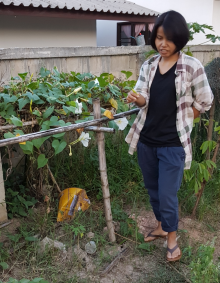
Photo: Examining roadside home gardens in Chiang Kham, Phayao Province, Thailand, with local farmer and President of Chiang Kham District Organic Agricultural Community Enterprise, Nirin Prasirthsang.
We believe a high-resolution inventory of commercial and domestic agriculture that does not rely for its integrity on farmer reporting and governmental record-keeping will be a treasure trove for researchers interested in the impact of the spatial arrangement of agricultural activities on food accessibility and security. This work will be piloted in Thailand because (i) Food accessibility at a household level in some provinces is a problem especially in isolated rural areas, despite there being a food surplus at the national level (Isvilanonda, 2011). Nationally, 40% of the population works in agriculture-related jobs, and 87% of the agricultural households were affected by food poverty as of 2007 (Luedi, 2016). (ii) There is good coverage in Street View. (iii) We have a team member and a consultant with extensive relevant local and agricultural knowledge.
Publications and Presentations
John Ringland, Martha Bohm, So-Ra Baek, 2019. Characterization of food cultivation along roadside transects with Google Street View imagery and deep learning, Computers and Electronics in Agriculture, Volume 158, 2019.
We describe the development of tools to exploit the enormous resource of street-level imagery in Google Street View to characterize food cultivation practices along roadside transects at very high spatial resolution as a potential complement to traditional remote sensing approaches. We report on two software tools for crop identification using a deep convolutional neural network (CNN) applied to Google Street View imagery. The first, a multi-class classifier distinguishes seven regionally common cultivated plant species, as well as uncultivated vegetation, built environment, and water along the roads. The second, a prototype specialist detector, recognizes the presence of a single plant species: in our case, banana. These two classification tools were tested along roadside transects in two areas of Thailand, a country where there is good Google Street View coverage. On the entire test set, the overall accuracy of the multi-class classifier was 83.3%. For several classes, (banana, built, cassava, maize, rice, and sugarcane), the producer's accuracy was over 90%, meaning that the classifier was infrequently making omission errors. This performance on roadside transects is comparable with that of some remote-sensing classifiers, yet ours does not require any additional site-visits for ground-truthing. Moreover, the overall accuracy of the classifier on the 40% of images it is most sure about is excellent: 99.0%. For the prototype specialist detector, the area under the ROC curve was 0.9905, indicating excellent performance in detecting the presence of banana plants. While initially tested over the road network in a small area, this technique could readily be deployed on a regional or even national scale to supplement remote sensing data and yield a fine-grained analysis of food cultivation activities along roadside transects.
Our Team


John Ringland with GLASS research students December 2018 L to R: Matt Straub, Matt Eichhorn, Niranjan Ravichandra, and Nick Lahue