News & information from UB, New York's flagship university
Volcanologist can discuss ‘Popo’, the ash-spewing volcano that has towns near Mexico City on alert


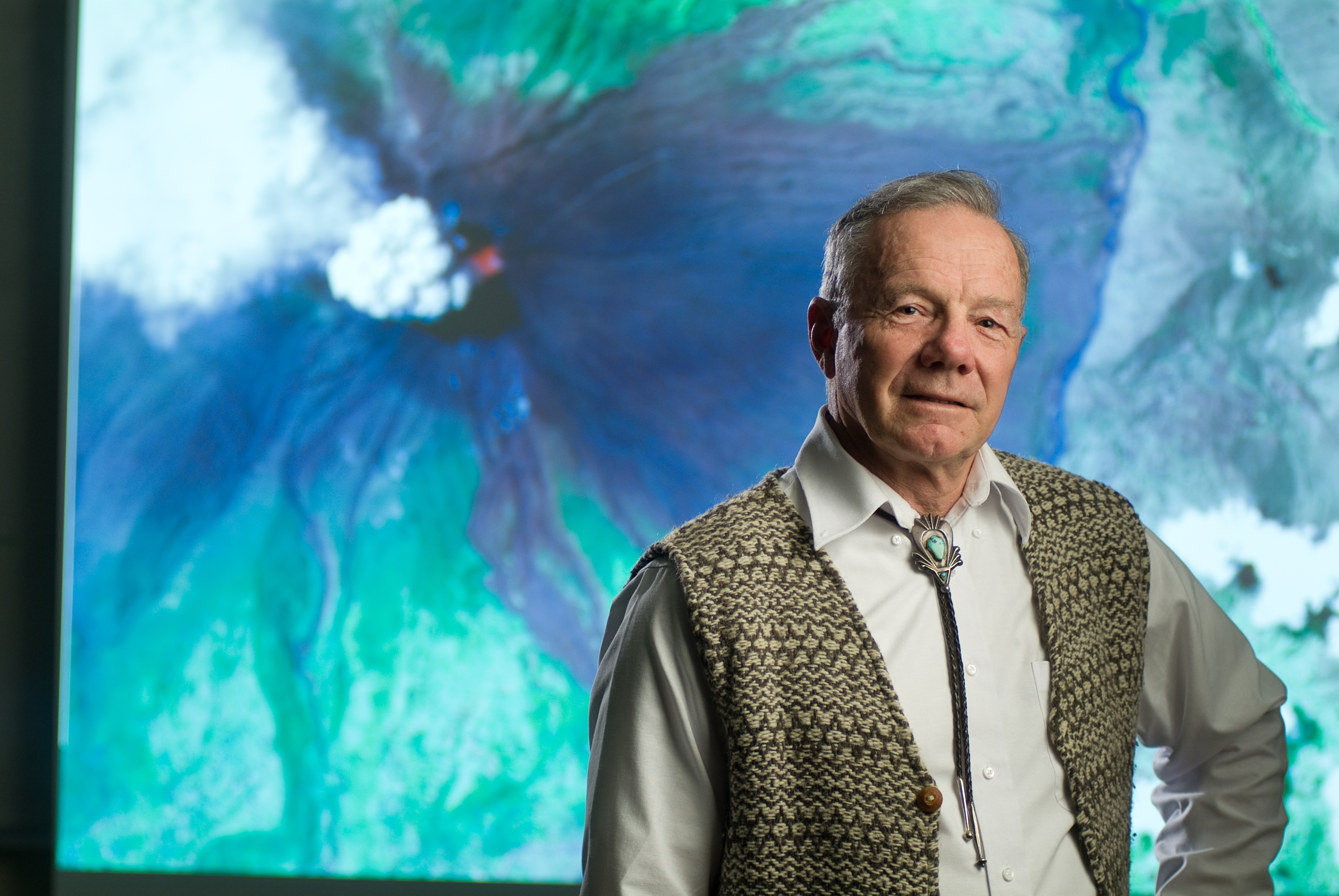
Michael Sheridan, Professor Emeritus of Geology.
Release Date: May 14, 2013 This content is archived.


BUFFALO, N.Y. — University at Buffalo volcanologist Michael Sheridan can discuss Mexico’s Popocatepetl volcano, which has been coughing up ash, gas and molten rock over the past few days.
According to news reports, this heightened state of activity has prompted Mexican authorities to begin preparing for a potential evacuation of nearby residents.
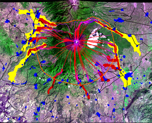
Sheridan, a professor emeritus of geology at UB, began studying ‘Popo’ in the mid-1990s. He was a member of the team that created the first hazard map of the volcano in 1995. This map is still used today, he said.
After a significant eruption in 2000, he worked with a team of researchers to develop a new map showing which communities around the volcano could be threatened by mud flows during a major event.
Reporters who wish to contact Sheridan can email him at mfs@buffalo.edu, or contact Charlotte Hsu at 716-645-4655 or email to get his phone number.
In the following Q&A, Sheridan discusses why Popo is one of the world’s most dangerous volcanoes, and why it remains difficult for researchers to predict major eruptions there.
Q: Why is Popocatepetl so dangerous?
A: Hundreds of thousands of people live within the ‘red zone’ of this volcano, in an area where there is significant risk during an eruption. This dense population makes it a very dangerous volcano.
There have been five huge eruptions at Popo since the end of the last ice age, about 14,000 years ago. If you visit some of the villages in the area, you can see that volcanic mud flows covered whole fields in ancient times. During one ancient eruption, blocks the size of a person’s fist landed in Mexico City.
Q: What’s the risk of a major eruption today?
Today, what we see is that the volcano has a big crater — really big, I mean, a mile wide and thousands of feet deep. That crater has been slowly filling with lava. The longer it builds up, the more dangerous it is because it becomes easier for an explosion within the crater to throw material out of the crater onto the steep volcano flanks where it can slide down the slopes toward inhabited areas.
Major events like this have happened in the past, so they could happen again. What’s difficult to predict is precisely when they will occur.
Q: Why is it so hard to predict the nature of eruptions at Popo?
A: It’s like a doctor diagnosing an illness. Once you have seen several cases of the same illness, you can see the pattern of symptoms in a patient leading up to the most severe conditions. You can forecast how the patient will progress.
For Popo, we don’t have that kind of data.
The last major eruption happened before we had the sophisticated instruments we have now, so we don’t have any record of the tremors, gas emission and ash ejection patterns that preceded major events.
Some volcanoes — including in Hawaii — have been erupting continuously and have had an observatory on them for a century. In these places, scientists are able to look at wiggles on seismograms and make a prediction about what will happen. That’s not the case for Popo.
Q: Please talk a little bit about the maps you created.
A: I participated in drafting two maps of Popo. The first map was completed in 1995 by an international team during the first months of the volcanic crisis. In 2000 we made a second map using computers to simulate small- and intermediate-sized mud flows at Popo because this appeared to be one of the important hazards that would develop with time. Using this information, we created a map showing where mud flows might travel during an event.
Such maps can’t be absolutely accurate because they represent a conceptual computer model, but they can be a helpful tool in demonstrating the danger that this volcano poses.
Q: What are some ways that people can protect themselves from volcanic mud flows?
A: They can identify places where they can be safe. In the event of mud flows, people should find higher ground and stay away from dry streambeds where mud could travel. That higher ground may be in the cemetery, because bodies are often buried in very dry places on a hill.
It takes the mud some time to get down the slopes of the volcano, so people may have as much as half an hour to get to higher ground. If a mud flow is coming, you shouldn’t spend a lot of time gathering valuables. You can get out of the way, but you won’t be able to save much. Just save yourself.
Media Contact Information
Charlotte Hsu is a former staff writer in University Communications. To contact UB's media relations staff, email ub-news@buffalo.edu or visit our list of current university media contacts.

