News & information from UB, New York's flagship university
Scientists win U.N. data prize for monitoring threats to South African biodiversity hotspot


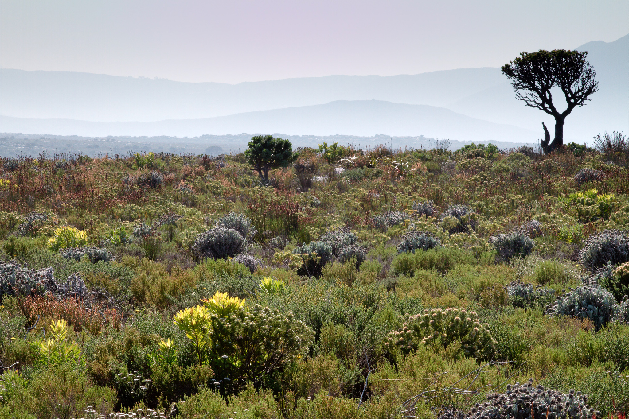
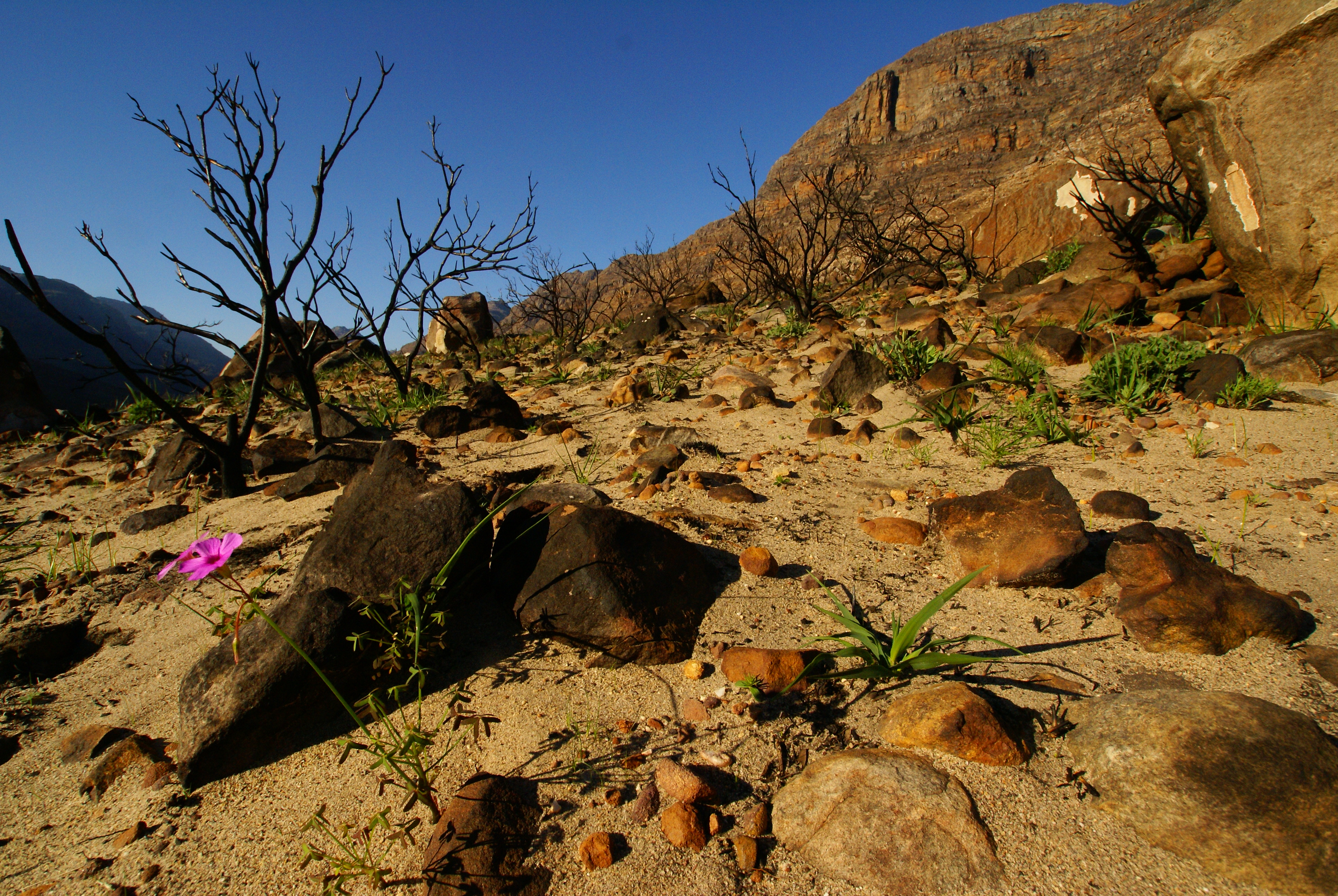
The fynbos of South Africa in Table Mountain National Park Cape Town. This ecologically important shrubland is found in the country’s Cape Floristic Region, which is one of the richest repositories of plant life in the world. Credit: Adam Wilson
The Cape Floristic Region is home to an estimated 9,000 plant species — many found nowhere else on Earth
Release Date: November 16, 2017 This content is archived.

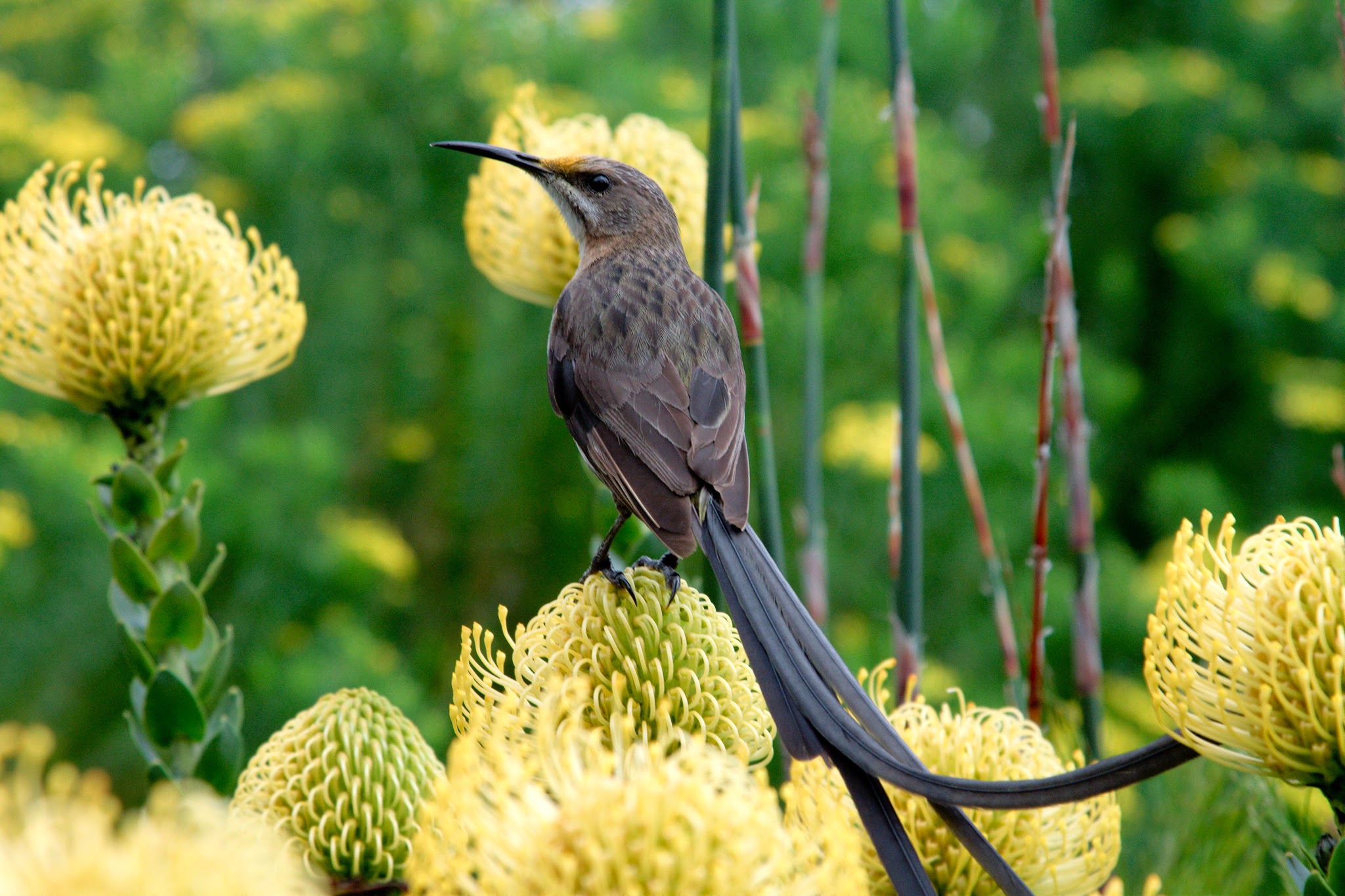
A Cape Sugarbird pauses in the fynbos, a belt of shrubland in South Africa’s Cape Floristic Region. Credit: Adam Wilson

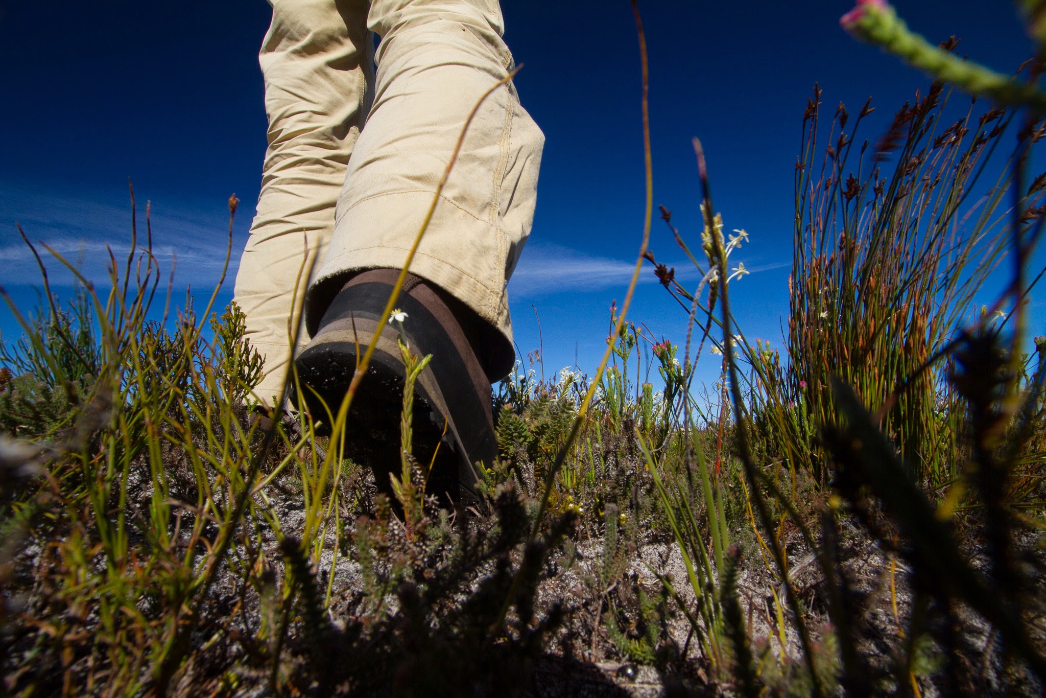
Researcher Adam Wilson walks in the fynbos. Credit: Adam Wilson
BUFFALO, N.Y. — South Africa’s Cape Floristic Region is one of the richest repositories of plant life in the world.
Here, about 20 percent of Africa’s flora grows in a landscape that accounts for less than 0.5 percent of the continent’s area, according to the United Nations Educational, Scientific and Cultural Organization (UNESCO).
The diversity of plant life is among the highest on the planet. About 69 percent of the region’s estimated 9,000 plant species live nowhere else in the world.
Now, a team of scientists including University at Buffalo biogeographer Adam Wilson has won a United Nations (U.N.) data prize for creating a digital tool for monitoring threats to this biological jewel.
The researchers — including Wilson, PhD; ecologist Jasper Slingsby, PhD, at the South African Environmental Observation Network (SAEON); and data scientist Glenn Moncrieff, PhD, at Ixio Analytics in South Africa — were one of six winning teams in U.N. Global Pulse’s Data for Climate Action Challenge, which asked scholars to use private sector data sources to address problems tied to climate change.
The group won the competition’s Thematic Award for Climate Mitigation.
The competition was hosted by U.N. Global Pulse — a flagship innovation initiative of the U.N. Secretary-General that aims to accelerate discovery, development and scaled adoption of big data innovation for sustainable development and humanitarian action — in collaboration with Western Digital Corporation and with support from the Skoll Global Threats Fund.
Wilson traveled to Bonn, Germany to receive the award on Nov. 12 at a companion event to the Sustainable Innovation Forum, a side event to COP23, the annual U.N. Climate Change Conference taking place from Nov. 6-17

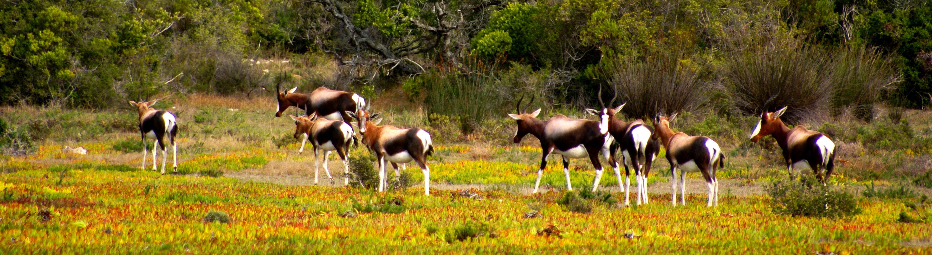
A herd of Bontebok in the fynbos, a belt of shrubland in South Africa’s Cape Floristic Region. Credit: Adam Wilson
Aiding conservation of South Africa’s fynbos


The digital tool the team created is a system that maps and analyzes vegetation in the fynbos, a belt of shrubland in the Cape Floristic Region that includes parts of protected areas forming a UNESCO World Heritage Site.
The system is capable of detecting abnormal changes in fynbos plant life.
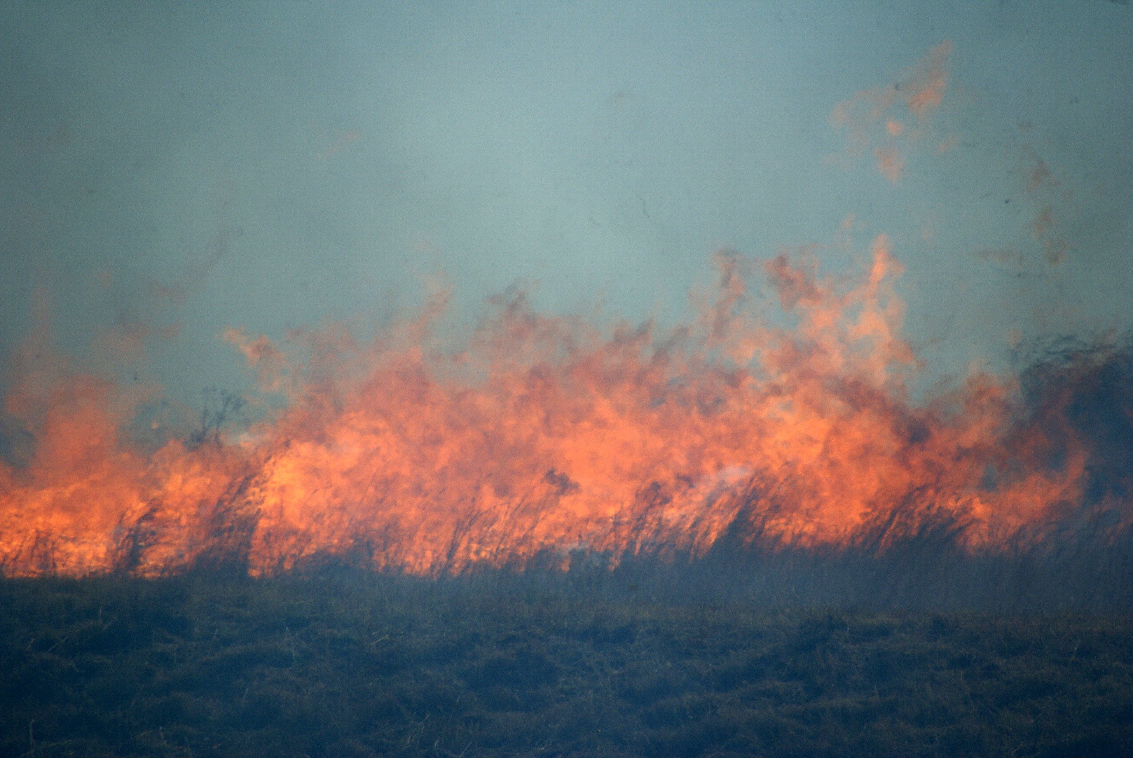
This is no easy task, as it requires distinguishing between unnatural aberrations — such as declines resulting from drought, development or climate change — and natural variations caused by wildfires, which are common in the region.
As Wilson explains, land in the fynbos burns roughly every six to 20 years, and fires are an important part of the life cycle of many local plants. The seeds of some species, for example, grow in cones that only open naturally after fire.
“Wildfire is an important part of the ecosystem, so there is a natural cycle of vegetation loss and recovery,” says Wilson, an assistant professor of geography in the UB College of Arts and Sciences. “To monitor this ecosystem, you need to be able to identify changes that fall outside of these natural variations, and our system does this quite well.”
“By detecting potential threats to the ecosystem in near-real time, our tool can inform the responses of conservation authorities, citizen scientists and policymakers,” Slingsby says.
Mapping threats to shrubland


The team’s tool is called EMMA — the Ecosystem Monitoring and Management Application.
It is still being piloted, but it includes an interactive, web-based map that researchers can use to compare expected vegetation status to actual changes seen in images from NASA’s Terra and Aqua satellites, and from Planet, a private company that provided high-resolution satellite images of the Earth through the U.N. Global Pulse data challenge.
EMMA also includes a smartphone app that field rangers, landowners and citizen scientists can use to map locations where they have spotted specific plant species in the wild, along with threats such as invasive plants, landslides and illegal clearing of vegetation.
“Systems like EMMA have been very useful for monitoring forest ecosystems, but we don't have any way of doing this in non-forest ecosystems such as shrublands and natural grasslands, as far as I am aware,” Moncrieff said. “The tool we’ve created could have a lot of utility for other fire-prone ecosystems, such as the Mediterranean Basin, California or South Western Australia.”

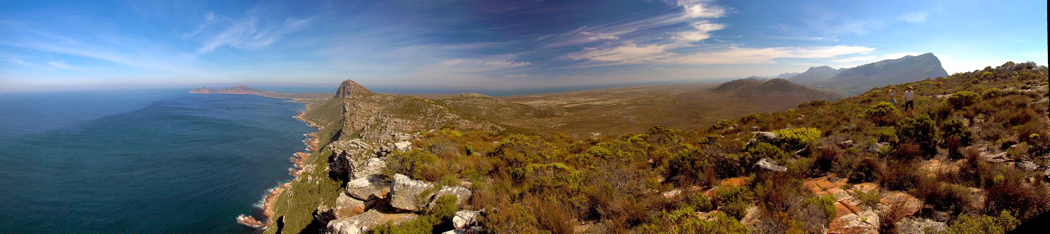
Panoramic view of the Cape of Good Hope, Africa’s Southwest most point. The fynbos of South Africa is an ecologically important shrubland found in the country’s Cape Floristic Region, one of the richest repositories of plant life on Earth. Credit: Adam Wilson
Media Contact Information
Charlotte Hsu is a former staff writer in University Communications. To contact UB's media relations staff, email ub-news@buffalo.edu or visit our list of current university media contacts.

