
News
UB project could help better manage
traffic during inclement weather
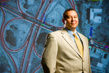
A transportation management system being developed by UB engineer Adel Sadek is designed to prevent the type of scenario that occurred last week when the Thruway was closed for 24 hours. Photo: DOUGLAS LEVERE
-
 Print
Print -
 Comments
(1)
Comments
(1)
-
“We are building a computer model of the Buffalo-Niagara region to help planners better manage the transportation system during inclement weather emergencies like last week’s snowstorm.”
Powerful, localized snowstorms can snarl traffic for hours or days, as Western New York saw last week when a section of the New York State Thruway closed for 24 hours. That’s exactly the kind of scenario that UB engineers hope to prevent when they complete a computer simulation of the area’s roadways.
UB researchers should have preliminary results from the Federal Highway Administration-funded project by this summer, with final results ready by spring 2012. UB’s partners on the project are the Greater Buffalo-Niagara Regional Transportation Council (GBNRTC) and the Niagara International Transportation Technology Coalition (NITTEC).
“We are building a computer model of the Buffalo-Niagara region to help planners better manage the transportation system during inclement weather emergencies like last week’s snowstorm,” says Adel Sadek, director of UB’s Transportation Systems Laboratory and associate professor in the Department of Civil, Structural and Environmental Engineering, School of Engineering and Applied Sciences.
“The simulation will capture what goes on under various emergency situations,” Sadek explains. “For example, we will be able to predict how closing one lane—or an entire section of the Thruway—will impact the region’s traffic patterns. That information will allow traffic planners to better plan when and how they should respond when inclement weather is predicted.
“We also will be able to simulate what is the impact of recommending alternative routes when traffic is diverted to local roads that are not designed to handle that volume of traffic, and how traffic signals could be retimed so that traffic on those roads goes more smoothly,” he says.
The simulation being developed at UB is dynamic and will reflect the amount of congestion typical for specific times of day, including morning and evening rush-hour periods.
“It will reflect how traffic capacity in the network gets reduced by inclement weather when people start driving more slowly because of slick road conditions and leaving longer headway between cars,” Sadek explains.
It also will include information on how specific inclement-weather conditions, such as poor visibility from blowing or drifting snow, change driving behavior.
“We have a car fitted with a GPS (global positioning satellite) system that we take out during snowstorms to precisely record how such events change the way drivers behave on the road,” he says.
The simulation under development at UB uses TRANSIMS (Transportation Analysis Simulation System), a software program developed at Los Alamos National Laboratory that is being modified by the UB transportation engineers.
Reader Comments
patrick su says:
Good, I like this project Hope for the best results
Posted by patrick su, RA, 12/06/10