
News
Geographers help map devastation in Haiti
UB geography students are participating in a global effort to enhance the international response and recovery effort to the earthquake in Haiti by helping to assess damage using images hosted by Google Earth and the Virtual Disaster Viewer, which shares imagery of disasters from various sources.
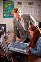
Eight graduate and undergraduate students are conducting the research under the direction of Chris Renschler, associate professor of geography, in his Landscape-based Environmental Systems Analysis and Modeling Laboratory (LESAM) in the Department of Geography, College of Arts and Sciences.
A research scientist with the UB site of the National Center for Geographic Information and Analysis, Renschler also is a member of the Remote Sensing Task Force of the Multidisciplinary Center for Earthquake Engineering Research (MCEER), headquartered at UB. The task force is conducting research on the resilience of communities to extreme events; that is, how well they can recover after a disaster.
“During the days and weeks since the Haitian earthquake, UB students and researchers have been part of an effort organized by ImageCat Inc., an MCEER affiliate, involving more than 500 individuals from 100 organizations around the world representing academia, government agencies, non-profit organizations and private industry, all of whom are working to classify the damage in Haiti,” says Renschler.
As a result, he says, by Jan. 25, more than 10,000 buildings had been identified as having been either totally destroyed or heavily damaged.
Renschler and his students are using the European Macroseismic Scale to classify images according to the amount of damage seen in them.
Those images, some of which were gathered by the Wildfire Airborne Sensing Program developed by the Rochester Institute of Technology, now are being made available to the international emergency-response community through the Virtual Disaster Viewer, an Internet-based graphical-user interface developed by ImageCat Inc., a California-based advanced technology company that is an industry partner in two LESAM research projects.
According to ImageCat, World Bank representatives in the field and at the bank’s headquarters have been using these images as soon as they became available on Google Earth shortly after the earthquake.
“The initial satellite-based damage assessments, along with the more-detailed aerial data, are together helping to provide a detailed picture of damage assessment to help create a picture of reconstruction and recovery needs, and to inform the World Bank response,” says Beverley Adams, managing director at ImageCat Inc.
The classification effort is helping the international community to better understand the scale of the disaster in Haiti and how best to begin recovery and reconstruction, Renschler says.
“This extreme event occurred in one of the least-resilient communities in the hemisphere with such enormous force that it is likely to emerge as the most tragic disaster since the 2004 Indian Ocean tsunami,” says Renschler. “As active collaborators in the extreme-events community, we knew we had critical capabilities that could provide enormous short- and long-term benefits to the emergency response in Haiti, as well as to the country’s ongoing recovery and reconstruction effort.”
In a related effort, Renschler and MCEER colleagues David Parisi, senior systems analyst, and Jane Stoyle Welch, publications manager, helped provide high-resolution, remote-sensing and topographic imagery of a World Bank-ImageCat-RIT reconnaissance mission arranged by the Information Products Laboratory for Emergency Response. IPLER is a National Science Foundation-funded partnership between UB and RIT dedicated to innovation in disaster management.
The UB-RIT researchers coordinated the transfer from RIT to MCEER’s Virtual Disaster Viewer of hundreds of recently gathered, high-resolution images and topographical data of the areas affected by the earthquake.
“This has been a huge team effort between RIT, UB and a host of collaborators,” says Jan van Aardt, associate professor of imaging science and director of the Laboratory for Imaging Algorithms and Systems at RIT. “If it had not been for this close-knit collaboration between the various teams, we never would have pulled this off,” van Aardt adds.
Renschler also is working with MCEER colleagues on research funded by the National Oceanic and Atmospheric Administration to develop a community-resilience index for communities along the U.S. Gulf Coast that were severely impacted by hurricanes Rita and Katrina. The index will be based on survey data, publicly available resources, and GIS and environmental models.
UB graduate students who are assessing the damage seen in Google Earth images of Port-au-Prince are Emmanuelle M. Ameroso, Jorge V. Bajo, Heather A. Collins, Amy E. Frazier, Sue Roussie, Jiue-an Jay Yan and Yan Yang. Ryan Mendieta, a UB undergraduate majoring in geography, also took part in the research.
The work that Renschler and others at UB are doing on the earthquake in Haiti reflects UB’s strategic strength in mitigation and response to extreme events that has been identified in the UB 2020 strategic plan.
Reader Comments